General


Wetland management

A wetland manager’s activities can range from wastewater treatment to waterfowl population management.

Importance of Wetland Management

Agricultural enterprises and ever-expanding urban areas pose a constant threat to wetland ecosystems. A wetland manager obtains the skills to identify boundaries of wetlands to help prevent unnecessary degradation of these valuable ecosystems. This process is known as wetland delineation.

Wetland delineation establishes the existence and physical limits of a wetland for the purpose of federal, state and local regulations.

Before wetlands were regarded as unique and valuable ecosystems, they were frequently viewed as wastelands. They were unable to be farmed or built upon because of their inherent ability to sustain water. Once they became recognized for their natural water-cleansing abilities and critical habitat for many forms of wildlife, governing agencies took measures to encourage their general preservation.  In 1988, a federally sponsored National Wetland Policy Forum raised public awareness of wetland loss and recommended a policy known as “No Net Loss.”

In 1992, the National Research Council set a goal of gaining ten million acres of wetlands by the year 2010, through creating and restoring wetlands.

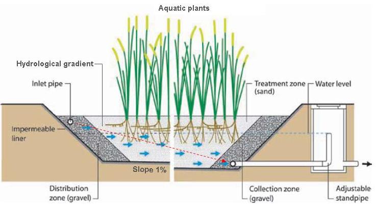
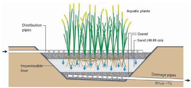
Wetland restoration is the process of returning hydrology (flooding) to areas of land by reversing drainage. Wetland creation, the process of developing a wetland where there was not one previously, is a growing area in wetland management that is expected to help counter the loss of wetlands to agriculture and urban sprawl.

Wetland Management Goals

  1. Maintain water quality
  2. Buffer stormwater
  3. Reduce erosion
  4. Control insect populations
  5. Produce and sustain wildlife populations
  6. Provide a natural system to process pollutants
  7. Maintain a diverse gene pool of native hydrophytic vegetation
  8. Provide habitat for fish spawning and other food organisms
  9. Provide aesthetic and psychological retreats for humans
  10.  Further scientific knowledge and inquiries

For more information about wetland management or if you are working on a project which requires environmental consulting, please feel free to contacts us.

References

Mitsch, William J., Gosselink, James G. (1993) Wetlands. New York, NY: Van Nostrand Reinhold

Ohio is aptly nicknamed the Buckeye State for the trees that are commonly found in floodplains and forests across the state.  The trees are frequently found in the western half of the state but are more scatte red in distribution throughout the eastern portion.  The Ohio buckeye (Aesculus glabra) has several prominent features that make it distinguishable year round.  During winter and early spring, the buds are large and conical with overlapping scales, and while similar in appearance to horse chestnut (Aesculus hippocastanum) buds, they are much less shiny and sticky. (more…)

According to the Ohio Department of Natural Resources, there are 11 species of bats (out of about 1,200 worldwide) found in Ohio. All are insectivores and the most common are the big brown and little brown bats. While bats may have a bad reputation among the general public, they are an important part of our environment and provide humans with many benefits. Unfortunately, bats face many human-caused challenges that threaten their future. Several species of bats are experiencing declining populations due to various factors, but there are opportunities to help turn around this unfortunate trend.

Why should you care about bats?

A colony of insectivorous bats can consume thousands, even hundreds of thousands, of insects over several weeks of feeding. This is beneficial to many people: from the teen at soccer practice who doesn’t want to be bitten by insects, to the local farmer who wants his crops to grow healthy and free of pest invasions. Recent research estimates that the loss of bats in North America could lead to agricultural losses estimated at more than $3.7 billion/year (crop loss & pesticide use) (Boyles et al., 2011). Bats are also important pollinators and seed dispersers. Nectar-feeding bats are critical pollinators for a wide variety of plants of great economic and ecological value. In North America, giant cacti and agave depend on bats for pollination. A few commercial products that depend on bat pollinators include: bananas, peaches, durian (a fruit), cloves, carob (a chocolate substitute) and balsa wood. Fruit-eating bats disperse seeds that help to restore forests, including rainforests that have been cleared. Because they are night foragers, they are not as wary of crossing the clear-cut areas as diurnal birds may be.

The Indiana Bat

The Indiana bat (Myotis sodalis) is a migratory tree-roosting bat that is listed as endangered at the state and federal levels. It spends winters in communal hibernacula, such as an old mine site, and migrates to forested areas in the summer, where individuals live under the bark of trees with peeling bark. These trees can be live trees with loose “peely” bark (like a Shagbark Hickory) or standing dead/dying trees of any species (called a snag) with loose bark or cavities that provide small hiding places. Males will often roost alone or in a small “bachelor colony.” Male Indiana bats have been observed roosting in trees as small as 3 inches dbh (diameter at breast height) (USFWS, 2013). Females, however, roost in maternity colonies that can number in the hundreds. Because of the high numbers, the maternity colonies require a larger tree (typically >9” dbh) that receives sun exposure for at least half of the day (USFWS, 2007). Maternity colonies will use multiple trees in an area and the proportion of bats using a specific tree determines if it is a primary or alternate roost tree. The colony will usually use 10–20 different trees each year, but only 1–3 of these are primary roosts. Proximity to water, such as streams or wetlands, is another important factor these bats will look for when selecting a roost site.

The population decline for this species is related to several main causes: white-nose syndrome (WNS), wind turbines, and summer habitat loss/fragmentation. WNS is caused by a whitish fungus (Geomyces destructans) that appears on the bats muzzle, hence the name. It spreads rapidly in communal hibernacula where individuals live in very close proximity. It is believed that humans brought the disease over from Europe and spread it around the country during caving activities. Stress from the fungus causes the bats to come out of hibernation too early. They do not have enough fat reserves and due to the time of year there is not a substantial food source.  Wind turbines pose a different threat. With the push for sustainable energy, large wind farms are being built. While these developments provide many benefits, the wind turbines can harm bats. The force of the spinning blades creates a change in pressure that ruptures capillaries along the edges of their lungs (Baerwald et al., 2008). Researchers are looking into this phenomenon and some believe that bats may be somehow attracted to the turbines. Solutions are being sought to reduce the potential for bat mortality around these installations. A third factor, summer habitat loss and fragmentation, removes or disconnects bats from areas they would use.  The removal of trees with sloughing bark or snags effectively reduces the amount of habitat available to bats within their summer range, creating greater competition for the available resources.  Tree removal and forest fragmentation also removes corridors that bats use while foraging. Indiana bats have been shown to exhibit site fidelity, returning to the same forested areas year after year, so removing forested areas and corridors can create an issue.  Not much is known yet as to how Indiana bats react to the loss of habitat in areas where they have exhibited site fidelity. Additional sources of population decline can be linked to pesticide use and cave alterations.

How can you help?

  1. Think before cutting. Bats may be living in your dead/dying trees or any live trees with peeling bark. Just because you think it no longer looks nice doesn’t mean it isn’t important. If it poses a safety issue or you really must remove it then try to cut it during the winter when bats are at their hibernacula.
  2. Install a bat box. Bat boxes provide bats with somewhere to live. This is especially helpful if you must cut trees down or remove bats that may have gotten into your house.
  3. Remove bats from your house safely. When bats get in your house it is often by mistake. Shutting off the lights and opening your doors and windows may help guide the bat outdoors. If bats are living in your attic the best way is to exclude them so they cannot regain entry. For more information visit Bat Conservation International’s site on Bat Removal.
  4. Volunteer! MAD Scientist & Associates recently volunteered with the Ohio Department of Natural Resources to complete acoustic surveys.  The data collected from this project will be helpful to develop an understanding of the range and preferred habitats types for bat species in Ohio.
  5. If you need to conduct a bat habitat evaluation as part of a project, please call MAD Scientists & Associates  and we can help you understand the regulations, survey your site, and assist you every step along the way.


Literature Reviewed:

Baerwald. E.F., G.H. D’Amours, B.J. Klug, R.M.R. Barclay. 26 August 2008. Barotrauma is a significant cause of bat fatalities at wind turbines. Current Biology.

J.G. Boyles, P. Cryan, G. McCracken and T. Kunz. 1 April 2011.  Economic importance of bats

in agriculture. Science.

USFWS Ecological Services. January 2007. Indiana Bat – Summer Life History Information for Michigan.

USFWS Great Lakes-Big Rivers Region. April 2007. Indiana Bat Draft Recovery Plan First Revision.

USFWS Midwest Endangered Species Program. April 2013. Revised Range-wide Indiana Bat Summer Survey Guidelines.

Green infrastructure is becoming more widely used to manage stormwater runoff, providing a natural means of limiting or eliminating combined sewer overflows and improving overall water quality.  Constructed wetlands and systems that mimic wetlands (for example bioswales, bioretention areas, and rain gardens) provide a cost-effective and environmentally conscious option that can result in an efficient and aesthetically pleasing wetland.  Additionally, constructed wetlands can provide valuable habitat for wildlife, including many amphibians, songbirds, and small mammals.  Constructed wetlands are classified according to their designed water flow; three common wetland designs are horizontal subsurface flow (HF), vertical flow (VF), or free surface wetlands (FSW).

Regardless of the type of treatment wetland used, each utilizes a process known as the root zone method (RZM) for removing bacteria, and excess nutrients, that negatively affect water quality.  The RZM can be summarized as follows: Influent (incoming) water passes horizontally or vertically through the soil and percolates the wetland bed.  The roots of wetland plants provide a pathway for the water to flow, and as the wastewater and solids move through the system they are treated by microbes that are contained near the plants’ roots.  The leaves of the plants absorb oxygen and transport it to the roots through their stems, which are hollow, and act as a bio-pump.  In the soil, or filter layer below the roots, anaerobic digestion treats the influent wastewater as well.  The type of substrate and plants included in the wetland design will vary depending on what the wetland has been designed to control.  Depending on the specific use of a treatment wetland, it may be necessary to pre-treat wastewater and remove large solids to prevent clogging of the substrate, which will reduce the effectiveness of the system.

In horizontal subsurface flow wetlands, water passes through emergent plants, and the RZM removes bacteria and excess nutrients at very high rates in a well functioning system.  After construction is complete, HF wetlands do not require significant maintenance, and many can function several years without maintenance.  Vertical flow wetlands utilize the RZM with a planted filter bed to treat wastewater as it flows through the system.  Typically the top layer is planted gravel above a layer of sand.  The deepest portion of the system is another layer of gravel that contains drainage pipes to collect and transport the filtered water as it percolates through the system.  VF wetlands are designed to be most effective when wastewater is applied in discrete intervals at a rate of 4-12 doses per day, and the wastewater is allowed to slowly percolate through the unsaturated layers of soil and sand.  Intermittent dosing is necessary to allow adequate oxygen transfer, which is necessary for aerobic degradation by the resident microbes.

Free surface wetlands are the most natural-looking treatment wetland option.  In these systems, water flows above ground and plants are rooted in the soil layer at the base of the wetland.  Typical design includes a basin lined with an impermeable layer, such as clay.  The substrate consists of rocks, gravel, and soil.  The basin is usually planted with native plants, and floating wetland islands can be used to supplement the plant coverage and increase system efficiency.  FSW wetlands are usually flooded with wastewater to a depth of 3-18 inches above ground level.  As the water slowly flows through the wetland and percolates into the soil, excess nutrients are taken up by the plants and potentially harmful bacteria may be trapped and degraded by microbial communities in biofilms on and near the plant roots.

Each type of treatment wetland has advantages and drawbacks that need to be carefully considered before developing blueprints and planning construction.  MAD Scientist & Associates has a proven track record with wetland design and construction, so if you are considering a constructed wetland for treatment or mitigation, we can help from the initial planning stages through construction and monitoring to make sure your wetland is a success.


Diagrams for Horizontal Flow and Vertical Flow Wetlands credited to:

Morel, A.; Diener, S. (2006): Greywater Management in Low and Middle-Income Countries, Review of different treatment systems for households or neighbourhoods.    Duebendorf: Swiss Federal Institute of Aquatic Science (EAWAG), Department of Water and Sanitation in Developing Countries (SANDEC). [Accessed: 19.02.2013].


Diagram for Free Surface Wetland credited to:

Tilley, E.; Luethi, C.; Morel, A.; Zurbruegg, C.; Schertenleib, R. (2008):Compendium of Sanitation Systems and Technologies. Duebendorf and Geneva: Swiss Federal Institute of Aquatic Science and Technology (EAWAG). [Accessed: 18.02.2013].

What comes to mind when you hear the term “wetlands?”  Since they are such diverse ecosystems it is often difficult to settle on a definition, but their importance is more apparent.  To explain some benefits of wetlands, here are some thoughts from the staff at MAD about the benefits (or “ecosystem services”) that wetlands provide.

Jenny:                                                                                                                                         “Wetlands are unique ecosystems that encompass the area where water meets land.  They support plant and animal communities that can rival the diversity found in rainforests.  Native wildlife rely on wetlands for year-round refuge, and migratory birds use them as a rest stop and fueling station.  In addition to providing great wildlife habitat, wetlands filter contaminants from runoff, buffer flooding events, and are a great place for outdoor education.”

Brent:                                                                                                                                          Wetlands improve the quality of surface water through numerous means.  Wetland plants aid in the uptake of excess nutrients, such as nitrogen and phosphorus that are found in runoff from agricultural fields and lawns.  This can help to reduce the occurrence and severity of harmful algal blooms.  Sediments found in runoff are able to settle out in wetlands, which helps clarify the water.”

When I think of wetland services, two aspects that immediately come to mind are important habitat and functions that protect the basis of all life — water.  Numerous species of fish, reptiles, amphibians, mammals, and birds rely on wetland habitat for breeding, foraging, and cover, in addition to using them for stopover during migration, as Jenny mentions.  Many threatened and endangered species, such as the blue-spotted salamander and black-crowned night heron require wetlands during their life cycle for activities ranging from breeding to hibernation.

As well as the water purification values that Brent describes, almost all wetlands provide flood protection by slowing the velocity of excess runoff from the spring thaw and storm events.  Wetlands do not prevent flooding, but peak flood heights are reduced by the temporary storage of water in wetlands, which act like a sponge, holding water in shallow pools and in the saturated soils.   Aquifers and groundwater are replenished and stream base flows are maintained by this stored water that seeps into the ground.  Wetlands connected to groundwater systems or aquifers are important areas for groundwater exchange.  Since water flows slowly through the wetlands, it allows time for the water to seep into the ground and enter aquifers.  Without wetlands, naturally clean drinking water sources would be difficult to find.

As efficient as wetlands are at providing these functions, they do have their limits.  Wetlands are not indestructible; in fact these diverse ecosystems are quite fragile.  A degraded wetland cannot meet its potential for flood control, groundwater recharge, or fish and wildlife habitat.  If we expect wetlands to continue performing their critical ecological functions, then we have to do our part to identify, protect, and restore them, and educate our communities on their profound importance to our shared environment.

-Luke Soposki-                                                                                                                         Environmental Scientist and Wildlife Specialist                                                                         MAD Scientist & Associates

By Tom Landwehr, commissioner, Minnesota Department of Natural Resources; John Jaschke, executive director, Minnesota Board of Water and Soil Resources

When Minnesota pheasant hunters go afield starting Saturday, they will head to prairie country, where tall native grasses provide food and shelter for this fast-flying and fine-tasting bird.

Unfortunately, Minnesota’s prairie country isn’t what it once was.

Long ago, Minnesota had about 18 million acres of native prairie. Today, that number is closer to 235,000 acres. Much wild was lost as society found ways to tame the land in the name of a noble pursuit – growing food for America and the global community beyond our borders.

While no one can turn back the hands of time. We can look to new ways to build a strong agriculture and prairie conservation partnership in the future. Forging a better future for prairie conservation and crop production is the right thing to do to help slow flooding, clean the state’s waters, shelter wildlife, provide for recreation and support our strong agricultural community.

Fortunately, there is a new tool to do this. It’s called The Minnesota Prairie Conservation Plan. It was finalized this past summer and identifies common goals among conservation organizations for the next 25 years. It will serve as a road map for protecting, restoring and enhancing prairies for the state’s primary conservation organizations, including the U.S. Fish and Wildlife Service, DNR, Minnesota Board of Water and Soil Resources (BWSR), Natural Resources Conservation Service, The Nature Conservancy, the Minnesota Prairie Chicken Society, The Conservation Fund, Audubon Minnesota, Pheasants Forever and Ducks Unlimited.

The DNR, BWSR and other partners look to work with landowners, agricultural interests and others to protect and enhance Minnesota’s prairie legacy.

The plan proposes to achieve conservation goals by:

  • Permanent protection of grasslands via easements and acquisition of critical lands from willing sellers.
  • Restoration activities including buffer strips, native plant seeding, wetland restoration and water level management.
  • Enhancement of prairies and grasslands through prescribed fire, conservation grazing and invasive species control.

Minnesota is at a crossroads. We have already lost 99 percent of our original native prairie and 90 percent of our prairie wetlands. In the next five years, nearly 800,000 additional acres of restored grassland is at risk due to expiring Conservation Reserve Program (CRP) contracts, and the current congressional stalemate on the next Federal Farm Bill prevents processing any new enrollments after Sept. 30, 2012. This leaves agricultural producers unable to predictably forecast and plan key aspects of their business.

It is Minnesota’s good fortune to have a funding option in the Clean Water, Land and Legacy Amendment, which can be used to ”protect, enhance and restore” the critical parts of the prairie landscape. Additionally, we need to seek opportunities to incorporate conservation into “working lands” – like grazing lands — so conversation can contribute directly to local economies and agricultural lands.

Now is the time to act, before the crisis is upon us. Our fish and our wildlife, including game and non-game species, depend upon native prairie, grasslands and associated wetlands for survival. We don’t want to look back one day and ask ourselves what we should have done to preserve the state’s grassland heritage.

Rather, let us act now for a future where we can visit the Prairie Region and be proud to have saved our grassland legacy – and the economic and conservation benefits it supports – for many future generations.

The Minnesota Prairie Plan is available online.

An Environmental Site Assessment (ESA), also known as Phase I Site Assessment, is a “due diligence” study of a particular site which is usually required by lending institutions or current property owners. An ESA is needed to identify potential environmental concerns on properties which may be used as “collateral” for loans or has been under a leased agreement by a third party. The objective of an ESA is to identify obvious, actual and potential through visual observation, aerial photographs, historical review, review of regulatory agency information and the presence of absence of asbestos containing building materials.

Ohio Environmental Consulting Firm

MAD provides quality wetland and ecological consulting to clients in the public and private sectors. Clients include engineering and environmental consulting firms, universities, park districts, industries, and municipal governments. Clients have come to rely on MAD Scientist & Associates for full wetland services (delineation, permitting, mitigation and monitoring), stream characterizations and aquatic studies, ecological risk assessments, botanical surveys, threatened and endangered species andcritical habitat surveys, and other specialized ecological services.

Swap the lab coat, goggles, and electrified hair for waders, sunblock, and a baseball cap and you’ve got me, a MAD Scientist that is living the dream.  I get to work with great people, do exactly what I went to school for, better our environment, enrich our local community, and (most importantly) play outside all day!  OK, I don’t really get to play outside every day, but when you do what you love, sitting in traffic and putting some hours in at the office doesn’t weigh you down like it can elsewhere.

Here at MAD Scientist & Associates, I am looking forward to breaking in my boots, kicking some invasive species’ butts, and turning degraded landscapes into beautiful, wildlife-packed wetlands.  On that note, I will explain my background and how I became “MAD.”  I first got the bug for wetlands during the final quarters of my bachelor’s degree in biology at Wright State University.  After taking a few field courses and experiencing the outdoors “off-the-trail,” I was hooked.  Part of the fun about working with wetlands is that everyday can be an adventure.  Sometimes you are completely surrounded by vegetation that towers over your head, other times you are hiking through shady wet woods to get to a vernal pool, and along the way, you can normally count on seeing a really neat plant or critter.

While it can be interesting visiting wetlands, another great part of my job is creating wetlands.  This, as you may imagine takes a lot of work, and can generally be an adventure for an entire community.  Much of what we do involves construction or enhancement of resources for the public (at parks, preserves, school sites, etc.).  We at MAD Scientist & Associates think this spells “opportunity” for educational experiences and science enrichment for schools, our volunteers (who help plant and maintain some of these sites), and the general public.  We encourage the community to participate in the development and management of public sites which not only makes the work go faster, but creates a sense of ownership and pride that will hopefully stick with the folks that will visit them for years to come.

I look forward to getting out in the field this season to meet some great people, as we work to protect, enhance, and care for some great natural resources!

Until next time,

~Jenny

EDITOR’S NOTE:  Jenny Adkins is the newest addition to the MAD Scientist & Associates team.  She brings an interesting and valuable skill set to the company, with experience (and a degree) in education, as well as considerable site management and wetland experience from positions she has held with the Miami County Park District and Five Rivers MetroParks.  Welcome, Jenny!

Recently, we received a phone call at MAD Scientist & Associates from a local citizen searching for a means of recycling his old TV. While we don’t provide recycling services, or consulting recycling services, the citizen guessed that, based on the services advertised on our website, we are interested in sustainability and might be able to assist him. He was right: we are very interested in sustainability and are aware of many local programs that provide e-waste recycling. Recycling electronic products properly is critical as they contain multiple hazardous metals including lead, mercury and cadmium that, when disposed of improperly, can leach into the soil, air and water, contaminating these resources. When deciding what to do with your old cell phone, it may not seem that your single phone would not contribute significantly to the problem. However, your phone is one of millions of electronic gadgets that will be disposed of each year. In fact, the UN’s Environment Program estimates that 20-50 million metric tons of e-waste is generated each year.

For those who may be looking for a facility to recycle electronic devices, a good place to start in central Ohio is with The Solid Waste Authority of Central Ohio (SWACO). While SWACO does not collect e-waste themselves, they do provide a list of e-waste recyclers in the area at www.swaco.org/RecycleElectronics.aspx.

One such company is Ohio eWaste recycling (www.ohioewaste.com), who for a small fee will accept most electronic items. They have a drop-off facility open Monday through Saturday, and also hold localized drop off events on specific dates. Check their website for dates and locations. Items with information storage capabilities that can not be re-purposed, are physically shredded so that your confidential information can not be obtained. After shredding the steel, plastic and metals are separated, sorted and for reuse.

If you have operable computers that you would like to donate to charity but are concerned about security issues, consider TechDisposal (www.techdisposal.com). They provide a complete audit of all your equipment, have several methods for destroying stored electronic information, and will provide you with a letter of indemnification and certificate of destruction. Clients can select a charity to have their computers directly donated to, or can choose to allocate the value of the donation to a particular charity.

With so many options for e-waste recycling, it should be easy to properly dispose of your used electronic devices.

~Jennie

http://www.environmentalconsultingohio.com/

In 1970, the Clean Water Act established a goal that our waterways should be “fishable and swimmable” and made it the obligation of every state to monitor and assess the chemical, physical and biological conditions of their streams and rivers.

In the U.S., the State of Ohio is at the forefront in the field of biological assessment.  This form of assessment, refined and “personalized” to our state by Ohio EPA, presents a particularly comprehensive and meaningful monitoring approach, as the animal communities in these aquatic systems effectively integrate a wide range of conditions and environmental variables over time.  In a grossly oversimplified description: If sources of degradation are present, sensitive species decline and tolerant or more adaptable species prevail.  The composition of the fish and invertebrate communities therefore reflect the relative health of the waterway.

To gain a better understanding of the process of developing biological assessment programs and to understand all the work that has gone into Ohio’s and other states’ programs, Rapid Assessment of Stream Health (Edited by D.L. Hughes, M.P. Brossett, J.A. Gore, John R. Olson, 2010) is a worthwhile read.  This book is not for the casual reader with an interest in stream health, however.  It is specifically geared toward the practitioner or environmental professional with a keen interest in understanding or even developing a regional bioassessment protocol.

The book starts with a basic introduction of concepts and the history of bioassessment, including discussions of Karr’s (1981) Index of Biotic Integrity Rapid Bioassessment Protocol (RBP) by Barbour et al. (1999), Hilsenhoff’s biotic index, and other related but lesser known indices.  It then compares and contrasts these methods and their ability to detect impairment of aquatic resources.  The author concludes through a summary of other published studies that their approaches show little difference in their ability to detect impairment, but stresses that methods should be selected with a full knowledge and understanding of the advantages and limitations of each.

In a very general sense, a regional bioassessment program requires the development of a robust baseline of data from reference sites (sites that have experienced no or only minimal degradatation) to which study sites may then be compared.  The goal is to get to a point where the knowledge of regional reference streams will allow biologists to establish an expected condition (E) to which observed conditions (0) at other potentially impaired sites may be compared (O/E).

The text highlights numerous aspects of rapid bioassessment development in an extensive material and methods section.  The book leans heavily on examples from the State of Georgia to demonstrate the process, although these methods could be used in any state or region – the same basic rules apply.  Reference sites should be selected with a solid understanding of degradation sources and processes, so that the least impacted sites may be identified as reference sites.  Sampling should follow standardized protocols to ensure the validity of future O/E comparisons, and supplemental physical and chemical data should also be collected in order to interpret potential influences on the biological components of the stream system.  And throughout the process, careful data analysis, database development, metric calculation and multi-metric index development should be used to establish appropriate and meaningful metrics and scoring breaks for the RBP being developed.  GIS mapping can be an extremely beneficial tool in this process.

The authors go into considerable detail regarding the calibration of metrics and numeric rankings, the importance of sample size and taxonomic resolution (should invertebrates be identified to species? Or is genus or family level identification sufficient?), the cost effectiveness of various approaches, and QA/QC procedures.

The final two chapters address the use of RBPs to assess stormwater best management practices (BMPs) for urban streams and implementation of RBPs by state agencies, which may be more topical given the emerging emphasis on stormwater management.  The book includes extensive data-rich appendices, comprising nearly 40% of the book, which could be useful to a practitioner planning a RBP program for their state or region (though I must confess, I did not spend much time with these appendices).

For any environmental professional wishing to improve their comprehension of rapid bioassessment, I would recommend this text.  If nothing else, it will give you a new-found respect for the biologists, planners, program managers and agencies that are leading these important efforts across our country.  But for the lay person or casually-interested citizen scientist, this book will be more than you bargained for.

~Mark

http://www.environmentalconsultingohio.com/

Next Page »